As most folks know, we at LeoLabs are focused on tracking objects in the Low Earth Orbit (LEO) regime. And with good reason. LEO is where the exponential growth is occurring in space, with an upcoming order of magnitude increase in the number of operational satellites across multiple large constellations. Additionally, there are hundreds of thousands of small pieces of space debris that have historically gone untracked by anyone, that we are rapidly working towards tracking ourselves. So we have our work cut out for us in LEO!
But sometimes it’s worthwhile to do some experiments, to show the art of the possible. Take our newest sensor — the Costa Rica Space Radar (CRSR). It’s a dual-radar system composed of two powerful S-band phased-array radars working in tandem. All CRSR hardware and software systems were designed by LeoLabs with the exclusive mission of tracking objects in LEO to support space traffic management and space domain awareness.
In April 2021, our team of data scientists put CRSR to the test in an attempt to detect some satellites in Geosynchronous Earth Orbit (GEO). Tracking anything in GEO with radars is traditionally quite difficult, as power requirements and complexity scale exponentially with distance to the target object.
For this experiment, we chose two large GEO satellites that happened to cross through the CRSR field of view — GOES-14 (35491) and AMOS-5i / AsiaSat-2 (23723). For context, these satellites are approximately 15x further away than the highest altitude cataloged objects we routinely track in LEO (36,000km vs. 2,400km).
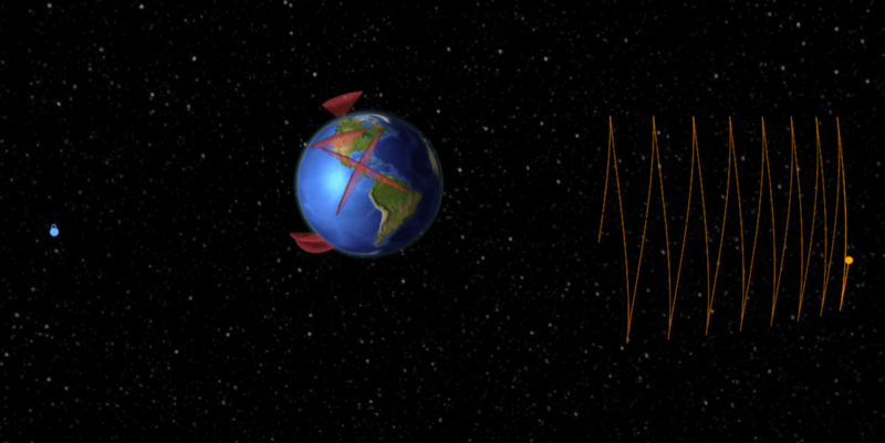
LeoLabs visualization of GOES-14 (left) and AMOS-5i / AsiaSat-2 (right)
Upon completion of the observation experiments, the results were conclusive: we saw strong detections on both satellites!
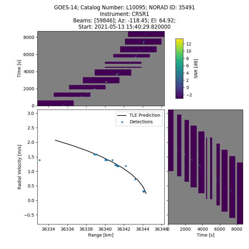
LeoLabs data plot showing CRSR measurement data for the GOES-14 satellite
The plots above show data from a LeoLabs test observation on GOES-14, which was in the radar’s field of view for a total of 10 minutes over a two-hour period. The top and right plots are Range-Time-Intensity (RTI) and Doppler-Time-Intensity (DTI) plots, respectively, showing signal strength reflected back to the radar. The central plot shows LeoLabs-collected measurements (blue dots) along with the predicted location of the object via the publicly available TLE.
Given that CRSR was not designed to track objects beyond LEO, but was able to detect GEO satellites with no hardware modifications, is a testament to the flexibility of our radars, software systems, and the ingenuity of our team of skilled engineers and data scientists.
We consider this experiment a successful proof of concept that our phased-array radar systems are highly capable to track beyond LEO, including MEO, GEO, and cis-lunar regimes.
We’ll be sharing more information about these GEO experiments in a technical presentation at the upcoming AMOS conference in Maui, Hawaii, so we hope you’ll join us there in-person or virtually.
