
The commercial off-the-shelf tracking service providing automated, independent monitoring for satellites - even those smaller than 1U in size.
Built on the LeoLabs data platform, the Tracking and Monitoring service leverages the LeoLabs global radar network and delivers precision tracking and curated orbit data products for satellites down to 1U in size or slightly smaller. Designed for operational use as a fully independent primary or backup tracking service for on-orbit satellites, operators can now have immediate access to affordable, accurate orbit information to inform operational decisions.
Get in Touch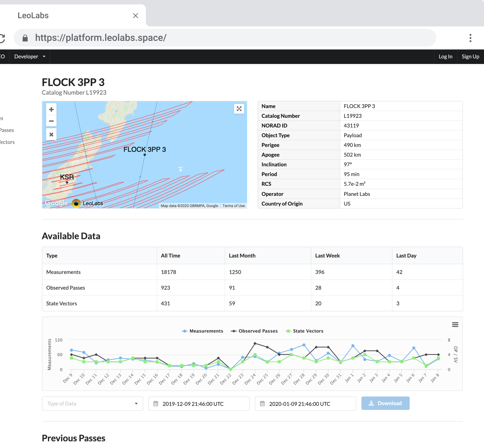
Tracking and Monitoring is provided as a web-based subscription service and includes the following features:
- Continuous tracking of your satellites with our global network of phased-array radars
- Fitted orbit state vectors and propagated ephemerides with covariances delivered on average 2-5x per day per satellite, depending on orbit and satellite characteristics
- Web dashboards including access to current and historical data, predicted next passes, state vector comparisons, and embeddable 2D/3D visualizations showing the location of your satellites in real-time
- Platform access via website or RESTful API
Services for Satellite Operators
Tracking and Monitoring is part of a broader set of services designed for satellite operators.
Learn More >>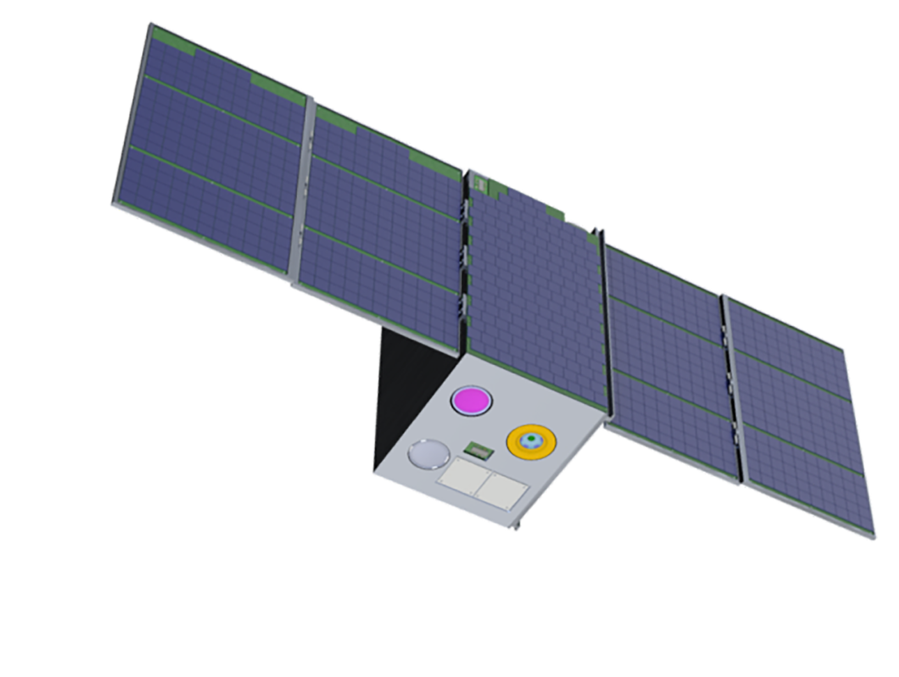
Tracking and Monitoring FAQs
- Know with confidence where your satellite is. Receive precision orbit state vectors including uncertainties without having to hire dedicated orbit analysts or purchase expensive orbit determination software. No need to rely on less accurate TLEs to make crucial operational decisions.
- Have known service levels you can plan for. Get a record of orbital state updates for your satellite, and know when to expect the next updates with planned radar pass information. Have access to not only the orbit states and uncertainties, but the quality levels and timeliness of the underlying data as well.
- Streamline and simplify your satellite operations. LeoLabs Tracking and Monitoring provides an off-the-shelf, cloud-based solution for your primary or backup navigation needs. A RESTful API allows for efficient system integration to access your satellite data products, visualize orbit states and covariances, and share data within mission operations centers or your company website.
Two Line Element sets (TLEs) have long been used to convey location information for space objects. However, TLEs are created from mean Keplerian elements, and by definition, represent an approximation to the true orbit path. They do not provide instantaneous precise location of satellites, and they do not contain uncertainty information that many satellite operators rely on to make informed operational decisions. TLE-derived positions often deviate from the true position by a few kilometers, and the errors can grow much larger as the TLEs are propagated for more than one day.
In contrast, LeoLabs Tracking and Monitoring delivers fitted orbital state vectors (positions, velocities and uncertainties) and propagated ephemerides at times up to seven days into the future, using high fidelity force models for Earth gravity and atmospheric drag. Our data products convey instantaneous positions of the tracked satellites, with uncertainties commonly well below 100m RMS at epoch for well-tracked objects. Typical ephemeris position uncertainties are less than a few hundred meters when propagated by one day.
We continuously monitor the accuracy and realism of our radar data by comparing our solutions with those of multiple reference objects, including International Laser Ranging Service (ILRS) satellites. From these comparisons, our automated system continuously updates our radar biases and residuals. Tracking and Monitoring also provides users with tools to monitor covariance trending and consistency between state updates.
We currently track operational cubesats as small as 0.25U (10cm x 10cm x 2.5cm). Contact us if you have a unique satellite size, and we will review the radar cross section (RCS) and reflectivity information and confirm our ability to track your satellite before you launch.
A new state vector is generated following each radar pass of a satellite. The frequency of state vector updates for any satellite depends on multiple factors, including orbital inclination, size of the satellite, altitude, and geometry of individual radar passes. On average, Tracking and Monitoring subscribers can expect new state vector updates to be delivered 2-5x per day, per satellite.
All our services are 100% web-based, with no software to install. We provide access to our data through our user website at platform.leolabs.space, or via RESTful API for ground system integration and automated delivery.
Got a question that's not listed here? Contact us at sales@leolabs.space and we'll be glad to help.
Featured Resources

Product Sheet
LeoLabs Tracking and Monitoring Service
LeoLabs, the world’s premier supplier of commercial data for low Earth orbit, provides its Tracking and Monitoring service available to satellite operators worldwide.
Read More >>


